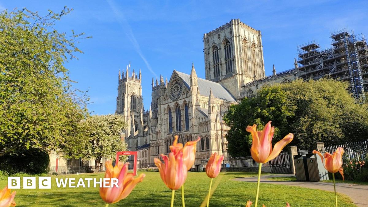
Friday was a warmer and sunnier day With more sunshine around, temperatures are rising again over the weekend. It won't be as hot as the start of this month when we saw thewarmest start to May on recordbut temperatures will get up to between 19 - 24C across most of the country. From Sunday onwards some parts may get much needed rain which is likely to be heavy with thunderstorms. But it's unlikely to amount to the sustained rainfall needed to head off the risk of drought this summer. Some parts of the country have been dry for a long time. According to the Environment Agency it has been the driest start to spring in 69 years across England. Some areas of the country have had no measurable rain for about 3 weeks. Leuchars, Morecambe and Bradford are a good example of how dry it has been. Each location has only had about 20% of the expected spring rainfall. Reservoirs are currently 84% full and there is nowa medium risk of summer droughtif there is no significant rainfall in the weeks ahead. No area is in drought yet and there are currently no plans for hosepipe bans. Rainfall and sunshine anomaly charts showing changes below and above the average for March and April. Data from the Met Office shows that not only has it been dry but it has also been very sunny. There has been more sunshine this spring already than we had during the whole of March, April and May last year. And if this continues it could be the sunniest spring on record - beating 2020 when there was 626 hours of sunshine. That was more sunshine than you would have most summers! This weekend looks like being very warm for most of us. Highest temperatures of 23 or 24C are likely to be in the Midlands, East Anglia and south-east England later this weekend. The sunny weather will continue on Saturday but on Saturday night the weather will start to change. There is an increasing chance of rain and thunderstorms moving across south-western parts of the UK. These will continue on Sunday and could spread to Northern Ireland. Heavy downpours and storms could continue across southern and western parts of the UK into Monday. There is still considerable uncertainty regarding the extent of rain and forecasting where thunderstorms will occur. Keep up to date on theBBC Weather app. And there will be many parts of England and Scotland that will miss the rain completely. Continuing to warm up this weekend with rain mostly developing in the southwest. Strong sunshine will lead to high UV levels for much of the country on Saturday. Levels will remain high in eastern Scotland, northern and eastern England and the Midlands on Sunday but will be lower elsewhere as the weather starts to change. You might be surprised to learn that the sun is as strong at this time of year as it is in August. The dry and sunny weather during spring has been due to the presence of areas of high pressure close to the UK. We have often had ablocked weather pattern, something which may become more frequent due to climate change. Rain and thunderstorms on Monday will then die out and next week another area of high pressure is expected to build across the UK from the north. It looks like it will be a 'dry high' with little cloud and no rain. With more blue skies it will continue to be warmer than normal for late spring. However, the last week in May could be very different. Most computer models show the high pressure moving away and areas of low pressure and weather fronts arriving in from the Atlantic. This change of weather type would mean lower temperatures, stronger winds at times and rain in all areas.
UK to see temperatures rise for the weekend
TruthLens AI Suggested Headline:
"UK Experiences Warm Weekend with Rising Temperatures and Potential Rain"
 Bbc News
8.4
Bbc News
8.4
TruthLens AI Summary
The UK is experiencing a warm and sunny weekend, with temperatures expected to rise between 19 to 24 degrees Celsius across most regions. This follows a particularly warm Friday, although the temperatures will not reach the record highs seen earlier this month, which marked the warmest start to May on record. Despite the pleasant weather, some areas are facing a potential drought due to a lack of rainfall, as many parts of the country have not seen measurable rain for three weeks. The Environment Agency has noted that this spring marks the driest start in 69 years for England. Reservoir levels are currently at 84% capacity, indicating a medium risk of drought if significant rainfall does not occur soon, although no areas are officially in drought status and hosepipe bans are not yet being considered.
As the weekend progresses, the weather is set to change, with rain and thunderstorms expected to develop, particularly in the southwestern parts of the UK. These storms may continue into Monday, with heavy downpours possible across southern and western regions. However, there remains considerable uncertainty regarding the precise timing and location of these storms, with many areas potentially missing out on the rain altogether. The dry and sunny conditions have been attributed to high-pressure systems over the UK, which have created a blocked weather pattern, a phenomenon that may become more common due to climate change. Looking ahead, another high-pressure system is anticipated to build across the UK next week, likely resulting in continued warm and dry conditions. Nevertheless, forecasts suggest that the last week of May could bring a significant shift in weather patterns, with lower temperatures and increased rainfall expected as low-pressure systems move in from the Atlantic.
TruthLens AI Analysis
The report highlights an increase in temperatures across the UK over the weekend, juxtaposed with concerns about potential drought conditions due to an unusually dry spring. The article presents a mix of positive and negative weather updates, indicating warmth and sunshine while also cautioning about possible rainfall that may not sufficiently mitigate drought risks.
Purpose Behind the Report
This article serves to inform the public about the current weather conditions and forecasts, creating awareness of both the pleasant aspects of the warmer weather and the underlying risks such as drought. By highlighting the record levels of sunshine and the potential for rain, the article aims to engage readers with a balanced perspective on the weather, which is particularly relevant during the spring season.
Public Perception
The report may foster a sense of optimism regarding the warm weekend while simultaneously instilling caution about the drought conditions. It encourages readers to appreciate the sunny weather but also to remain aware of the environmental implications of prolonged dryness. This dual narrative can create a feeling of urgency regarding water conservation and awareness of climate patterns.
Omissions and Hidden Aspects
There does not seem to be any overt attempt to manipulate information or hide critical facts. However, the report could downplay the severity of the drought by emphasizing the potential for rain without stressing how insufficient it may be. The mention of reservoir levels being 84% full might mislead some readers into thinking there is no immediate concern, despite the noted risk of drought.
Comparative Analysis
When compared to similar reports on weather patterns and climate change, this article appears to align with a trend of raising awareness about the impacts of changing weather conditions. It does not seem to be directly connected to other news stories but fits within a broader narrative about climate variability and its consequences.
Impacts on Society and Economy
The information in this report could influence public behavior regarding water usage as awareness of drought conditions grows. If the anticipated rainfall does not alleviate drought risks, it could lead to discussions about water conservation and potential restrictions, impacting agriculture and water-dependent industries.
Target Audience
The article likely appeals to a broad audience, including those interested in weather updates, environmental issues, and outdoor activities. It seeks to engage individuals who may be planning weekend activities and are concerned about both the enjoyment of warm weather and the implications of drought.
Market Implications
From a financial perspective, this report might impact sectors such as agriculture, tourism, and utilities. Companies that rely on water resources could be particularly affected. Investors in these sectors may need to monitor weather forecasts closely for potential impacts on productivity and costs.
Geopolitical Relevance
While this report primarily addresses local weather issues, it indirectly connects to larger discussions about climate change and its global implications. As weather patterns become increasingly erratic, the conversation around climate resilience and sustainability grows more pertinent.
Use of AI in Article Creation
It is possible that AI tools were employed in drafting this article, especially in data analysis and weather prediction. The structured presentation of weather data and statistical comparisons suggests a methodical approach that AI could facilitate. However, the narrative style indicates human oversight, focusing on engaging the reader while providing relevant information.
Manipulative Elements
There are no clear manipulative tactics, although the framing of the sunny weather may overshadow the seriousness of drought conditions. The language used aims to balance positive and negative aspects, which could contribute to a skewed public perception if not critically evaluated.
In conclusion, while the article provides factual updates on weather conditions, it carries an underlying message about the importance of water conservation, reflecting broader environmental concerns. The reliability of the information appears sound, based on data from reputable sources like the Met Office.