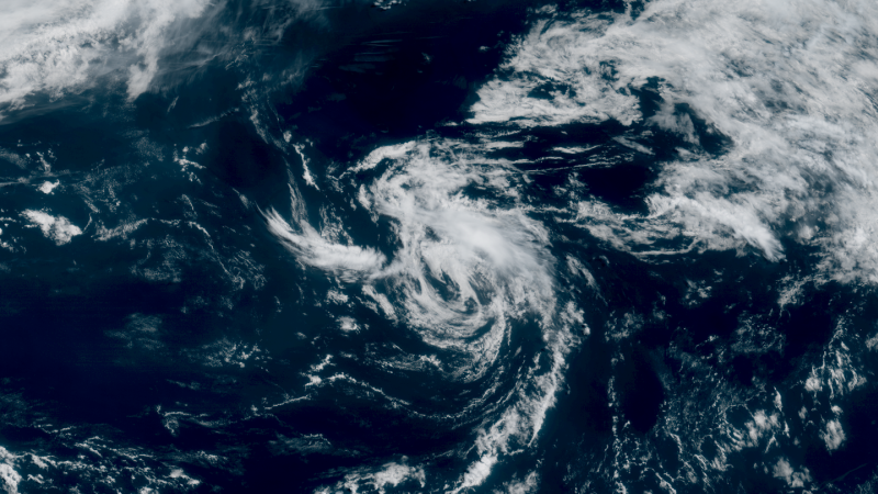
On Tuesday morning, the National Hurricane Center reported the formation of Tropical Storm Andrea, marking it as the first named system of the Atlantic hurricane season. The storm, which is located approximately 1,200 miles away from The Azores and about 1,400 miles east of the US East Coast, has maximum sustained winds of 40 mph. As of 11:00 a.m. ET, meteorologists indicated that Andrea is projected to move northeast at a speed of 17 mph. Fortunately, the current trajectory of the storm poses no threat to land, and there are no coastal watches or warnings in effect at this time. This early development in the hurricane season highlights the unpredictable nature of tropical weather systems in the Atlantic Ocean.
Tropical Storm Andrea is expected to dissipate by Wednesday, which suggests a relatively short lifespan for this system. The formation of Andrea comes as the Atlantic hurricane season typically runs from June 1 to November 30, with each season bringing the potential for hurricanes and tropical storms. While Andrea is not currently a danger to coastal areas, its development serves as a reminder for residents in hurricane-prone regions to remain vigilant and prepared for the upcoming season. As this situation evolves, further updates from the National Hurricane Center will provide additional information regarding the storm's status and any potential changes in its path or intensity.