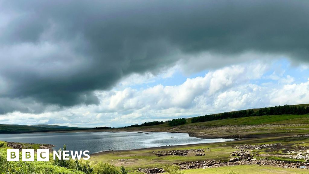
After record-breaking June temperatures and a searing start to July for many in England, it looks as though there will be no return to heatwave conditions in the near future. After Tuesday officially became the hottest day of the year so far - with a temperature of 34.7C (94.4F) recorded in London's St James's Park - the outlook for the start of July is much cooler. More comfortable temperatures have already set in across the country, with some places more than 10C cooler than they were earlier this week. Over the next 10 days, short-lived hot weather spells are expected - but a return to heatwave conditions is not forecast for the first half of this month. Wednesday's temperatures will range between 16C to 26C north to south. Tonight will also be cooler, fresher and more comfortable. Temperatures for much of the next week will be in the mid to high teens in Scotland and Northern Ireland and low to mid-20s in England and Wales. However, Friday will likely be the warmest day, when we could see 27C or 28C in the far south-east. After the driest spring on record and a dry start to summer for many, especially in England, there is some rainfall expected over the next five days. The majority will fall in the north-west of the British Isles. Yorkshire and North-west England are already in drought, and the Environment Agency says two thirds of England's river flow are currently classed as "below normal or lower for the time of year". Eastern Scotland and parts of Wales are also seeing low water levels. Thursday and Friday will see some outbreaks of rain, mainly in Scotland and Northern Ireland. Temperatures throughout the weekend will be widely unsettled across the UK and showers will be unpredictable. It is likely that higher pressure will build again into the second week of July, meaning the chance of rain will be lower. This week marked the second UK heatwave of 2025. It lasted six days for parts of Yorkshire and the Humber, and five for people in central and eastern England. An official heatwave is declared when locations reach a certain temperature for three consecutive days. The thresholds vary from 25C to 28C in different parts of the country. It was the result of a large area of high pressure getting "stuck" over Europe – dubbed a "heat dome" by some - and high temperatures are becoming increasingly common in the UK. Scientists have emphasised the role of climate change in these sizzling summers, saying that heatwaves will likely become more frequent and hotter in the future.
Cooler weather conditions set in across UK as heatwave ends
TruthLens AI Suggested Headline:
"UK Experiences Cooler Weather Following Recent Heatwave"
 Bbc News
8.6
Bbc News
8.6
TruthLens AI Summary
The weather across the UK has shifted significantly from the record-breaking temperatures experienced in June and the beginning of July. After London recorded its hottest day of the year so far, with a high of 34.7C (94.4F) in St James's Park, cooler conditions have now settled in across the country. The temperature drop is substantial, with some regions reporting figures more than 10C lower than those observed earlier in the week. The forecast indicates a range of temperatures between 16C and 26C across the UK, with tonight expected to bring a fresher and more comfortable atmosphere. While short bursts of warmer weather may appear over the next ten days, the likelihood of heatwave conditions returning in the first half of July is minimal. The warmest day of the week is anticipated to be Friday, particularly in the far south-east where temperatures could reach 27C or 28C.
In addition to the cooler temperatures, the UK is also facing a potential shift in precipitation patterns following an unusually dry spring and early summer. Predictions suggest that rainfall is on the horizon, particularly in the north-western regions. Areas such as Yorkshire and North-west England are already experiencing drought conditions, with the Environment Agency reporting that two-thirds of England's river flow is currently classified as below normal. Eastern Scotland and parts of Wales are also suffering from low water levels. While Thursday and Friday may bring some rain, particularly to Scotland and Northern Ireland, the weekend is expected to be unsettled with unpredictable showers. As we move into the second week of July, higher pressure systems may re-establish, reducing the chances of rain. This recent heatwave, which lasted up to six days in parts of the UK, was attributed to a persistent high-pressure system over Europe, highlighting the increasing frequency and intensity of heatwaves due to climate change.
TruthLens AI Analysis
You need to be a member to generate the AI analysis for this article.
Log In to Generate AnalysisNot a member yet? Register for free.