The King’s birthday long weekend could be the snowiest start to an Australian ski season in years, forecasters predict.
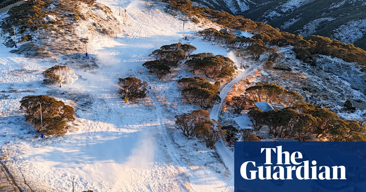
Weatherzone said up to 70cm of snow could accumulate at the higher resorts by Tuesday evening, with at least 15cm to 30cm at lower resorts.
A strong cold front in the Great Australian Bight will move in overnight, weatherzone meteorologists said, bringing with it dumps of snow.
Jonathan How, from the Bureau of Meteorology, said south-east Australia can expect “very cold” and windy conditions over the three-day weekend.
Melbourne is forecast for a high of 15C on Saturday and a low of 6C on Monday. The weekend in Sydney should be mostly sunny with possible showers, with expectations of a high of 19C on Saturday followed by 8C on Monday, the bureau said.
On Friday, a severe weather warning was issued forSouth Australiaand south-west Victoria. Rain is predicted to break a record drought for the region.
Damaging winds could top 90km/h on Friday, impacting parts ofVictoria, including the Otway ranges and Mornington Peninsula. Gusts are predicted to increase and move into South Australia on Friday afternoon, reaching Adelaide and the Mount Lofty ranges.
Sign up for Guardian Australia’s breaking news email
The strong winds will continue on Saturday through Victoria and SA, the bureau said.
The coldest weather will arrive in a second cold front, which will reach SA potentially on Sunday morning, bringing thunderstorms and hail. Adelaide has a predicted high of 17C on Saturday and low of 6C on Monday.
Melbourne will not be impacted by the damaging winds on Friday, but the city will experience a strong wind chill and showers that will also reach the Yarra Valley and Macedon Ranges.
The cold front will move into south-east NSW by Friday evening.
How cautioned black ice will pose a risk over the weekend across NSW and Victoria. “Take care if you are heading up to the slopes this weekend for the snow,” he said.
Snow showers are predicted across the alps of Victoria and NSW, with snow levels in those regions predicted to drop to 1,500m by Friday.Snowlevels will fall further on Saturday to about 1,150m.
How said he expected high snow accumulation between 30cm and 70cm around alpine ski resorts, with the potential to move to lower regions. “We may even see some blizzard conditions across some of those alpine peaks,” he said.
On Sunday, snow levels are expected to fall to 800m in Victoria and NSW and 900m in western Victoria, including the Grampians.
Sign up toBreaking News Australia
Get the most important news as it breaks
after newsletter promotion
In Tasmania the snow level is predicted to drop to 1,000m on Saturday. Hobart is set for a chilly low of 4C on Sunday and maximum of 15C on Saturday.
Despite what looks to be a snowy beginning to the ski season,a warm winter is forecast for Australia.
Professor Emeritus David Karoly, from the University of Melbourne and the Australian Climate Council, said there is clear evidence of snow cover declining and snow season length reducing due to global warming.
“It’s long-term warming due to human-caused climate change from burning fossil fuels,” he said.
Karoly said last year’s snow season started similarly to this year, with relatively good snow early on, but due to high temperatures and low snowfall there was not enough to maintain snow for the whole season.
He said the impact of climate change from Australian and global emissions, with a new world record for climate pollution set in 2024, will cause continued decline in snow cover and snow season length until at least2050 – the current target date for net zero emissions.
“By that stage there will be very, very few commercially viable ski areas in Australia even with increases in snowmaking on the resorts,” he said.
He said lack of action from powerful countries like the US to reduce their emissions and the Australian government’s expansion of the North West Shelf pas project “will make it virtually impossible to meet its commitments for zero emissions by 2050”.