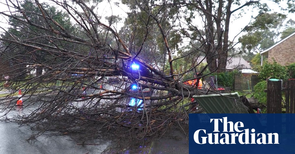
Thousands are without power acrossNew South Walesafter severe winds and heavy rain battered the state, with wind gusts up to 122km/h and several places receiving more than 200mm rain.
The NSW State Emergency Service has responded to more than 2,320 incidents since a vigorous coastal low began lashing the state’s east coast, bringing intense rainfall and strong winds.
The majority of incidents involved fallen trees, powerlines and damaged roofs, the NSW SES said. Flood rescue crews also responded to numerous incidents related to flash flooding around Shoalhaven overnight Tuesday.
At least 35,000 remained without power on Wednesday morning, according to network operators Ausgrid, Endeavour Energy and Essential Energy.
Sign up for Guardian Australia’s breaking news email
Residents of Wamberal and North Entrance on the NSW Central Coastwere asked to evacuate on Tuesdaydue to coastal erosion, with warnings ongoing on Wednesday morning for dangerous waves which could significantly damage buildings, and the NSW SES door-knocking those affected.
The Bureau of Meteorology reported widespread falls of 50 to 100mm across the Illawarra and the south coast in the 21 hours to 6am Wednesday.
Significant rainfall totals included Morton, which received 242mm, Ulladulla 223mm, Willinga Lake 203mm, and Fitzroy Falls and Robertson both received 200mm.
Wind gusts of 122km/h were recorded at Montague Island, 104km/h at Penrigh and 104 km/h at Ulladulla, and 102km/h gusts were recorded atSydneyharbour, according to the bureau.
The hazardous conditions were not over yet, said bureau meteorologist Helen Reid, with numerous warnings still in place on Wednesday.
“There is a severe weather warning for damaging winds and heavy rainfall, which extends across the NSW coastal fringe from Forster to Bega into the alpine areas of parts of the southern tablelands and the northern tablelands as well.”
Average gale-force wind gusts of 60 to 70km/h were forecast, and the possibility of gusts up to 110km/h. Areas affected included Newcastle, Gosford, Sydney, Wollongong, Armidale, Batemans Bay, Tenterfield, Moruya Heads and Penrith.
“Winds could bring down trees or tree limbs, lead to dangerous driving conditions due to crosswinds or debris being thrown across the roads, [and] lead to power outages and possible damage to cars and property,” Reid said.
A driver was in critical condition after a tree fell and crushed his truck in Moss Vale in NSW’s southern highlands overnight. NSW police said the 55-year-old driver was unconscious as police officers and emergency service workers extracted him. He was treated for serious injuries to his head and torso before being taken to hospital.
Conditions remained hazardous along the coast, across an area stretching from Seal Rocks to the Victorian border, with the potential for damaging surf, coastal erosion and damage to infrastructure.
Sign up toBreaking News Australia
Get the most important news as it breaks
after newsletter promotion
A widespread flood watch was still in place for catchments across the Hunter, central coast and tablelands, Illawarra and southern coast, with the expectation of minor to moderate flooding over coming days.
The NSW SES issued emergency flood warnings for residents at Burrill Lake – where about 200 properties were impacted by flooding, some over floor level – to take shelter. Sanctuary Point residents were also under an emergency warning.
Watch and act warnings were in place due to flooding for Lake Conjola, Burrill Lake, Lake Tabourie, St Georges Basin and surrounds.
The state’s acting SES assistant commissioner, Allison Flaxman, said flash flooding was a significant risk and urged the community to take caution on roads.
“Roads are slippery and conditions can become dangerous quickly,” she said.
“Please never drive, walk or play in flood waters. If you do come across a flooded road, turn around and find an alternative route.”
The vigorous coastal low, which was still lingering off the central Illawarra coast, was expected to continue to direct severe weather across eastern NSW for much of Wednesday, before gradually easing on Thursday.
